Geomatics involves the collection and management of geographically referenced information while GIS involves the collection, storage, analyzing and visualization of geographical information.
This part covers how scientists are deciphering the physics of earthquakes, developing technology to study them, discovering how quakes evolve and more.
The main goals of Space (satellite) geodesy are: Satellite geodetic data and methods can be applied to diverse fields such as navigation, hydrography, oceanography and geophysics. Satellite geodesy relies heavily on orbital mechanics.

Data science is the combination of: statistics, mathematics, programming, and problem-solving, capturing data in ingenious ways
LASAC will arrange ZY-1 02D satellites to acquire images of Armenia upon the request of the IGES
LASAC will provide ZY-1 02D data and data processing service to the IGES, such as free-of-charge images of ZY-1 02D satellites and other necessary image products, according to the requirement of the university for research projects
LASAC and the Institute of Geophysics and Engeneering Seismology will jointly carry out satellite surveying, mapping and geoinformation application technology research, personnel exchanges and cooperation, jointly carry out the projects.

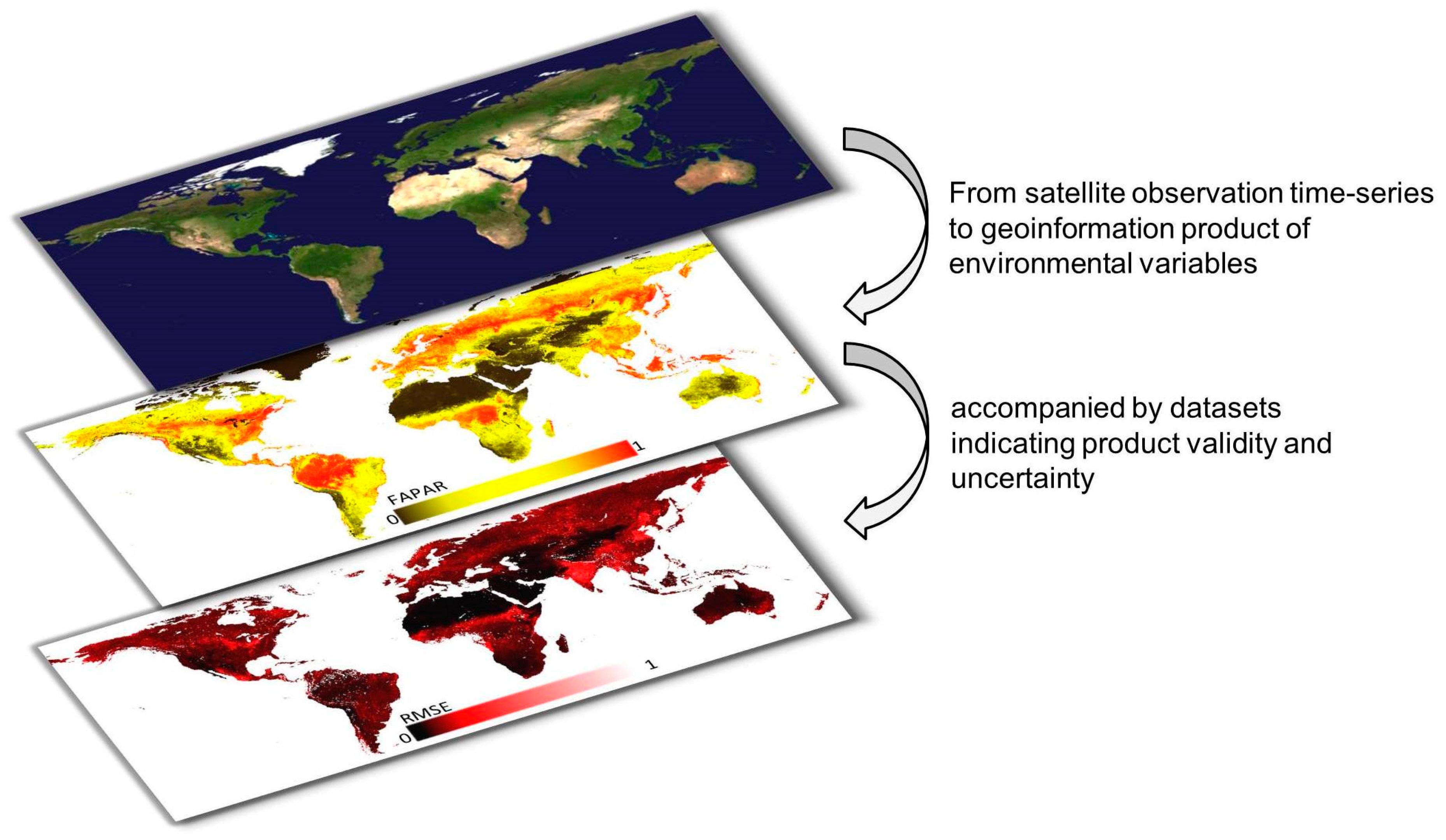
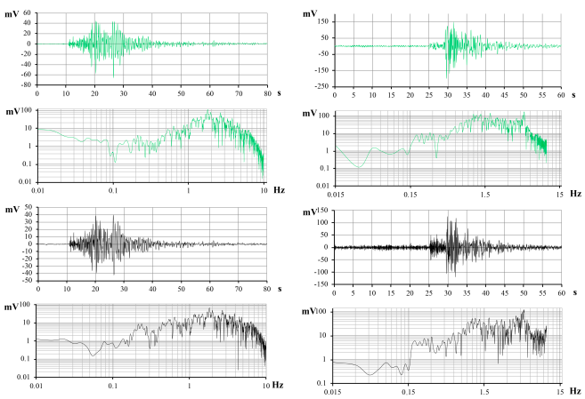
Welcome to the Mathematical Geophysics and Geoinformatics (MGG) Research Group at the Institute of Geophysics and Engeneering Seismology after A. Nazarov! The MGG studies geophysical processes in various layers of the Earth, seismic hazard assessment, eartquake rediction etc. are basic, fundamental, and applied problems for the territory of the Republic of Armenia. It will allow us to develop a physical foundation for the creation of technologies and systems to prevent natural and man-made extreme and emergency situations. To solve these problems, new knowledge in the field of Earth physics is required, as well as a transition to the use of modern methods and approaches of mathematical geophysics (incluing discrete mathematical analysis, modern methods, and algorithms of geoinformatics, new mathematical tools for processing large volumes of geophysical information). In the proposed project, fundamentally new physical and mathematical models will be built and tested, mathematical algorithms for operational forecasting of earthquakes will be developed using patern recognition methods and modem artificial intelligence tools. To this end, within the framework of the project, a group of scientists from IGES NAS RA will be supplemented by geophysics, mathematics, information technology, GIS technologies, iding machine learning), etc.
We are always looking for more talented, passionate people. Research opportunities are available for graduates and undergraduates. Contact us for further information.